
Thank you for supporting this site ❤️
Make a donation
Make a donation
Gear up for your next adventure:
As an Amazon Associate, this site earns from qualifying purchases at no extra cost to you.
Domo topographic map
Click on the map to display elevation.
Thank you for supporting this site ❤️
Make a donation
Make a donation
Gear up for your next adventure:
As an Amazon Associate, this site earns from qualifying purchases at no extra cost to you.
About this map
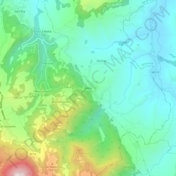
Name: Domo topographic map, elevation, terrain.
Location: Domo, Serra San Quirico, Ancona, Marche, Italy (43.38166 13.04083 43.42166 13.08083)
Average elevation: 1,444 ft
Minimum elevation: 791 ft
Maximum elevation: 3,182 ft
Thank you for supporting this site ❤️
Make a donation
Make a donation
Gear up for your next adventure:
As an Amazon Associate, this site earns from qualifying purchases at no extra cost to you.