
Thank you for supporting this site ❤️
Make a donation
Make a donation
Gear up for your next adventure:
As an Amazon Associate, this site earns from qualifying purchases at no extra cost to you.
Cepos topographic map
Click on the map to display elevation.
Thank you for supporting this site ❤️
Make a donation
Make a donation
Gear up for your next adventure:
As an Amazon Associate, this site earns from qualifying purchases at no extra cost to you.
About this map
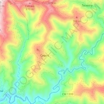
Name: Cepos topographic map, elevation, terrain.
Location: Cepos, Cepos e Teixeira, Arganil, Coimbra, 3300-222, Portugal (40.13631 -7.99554 40.18664 -7.94216)
Average elevation: 1,906 ft
Minimum elevation: 1,073 ft
Maximum elevation: 3,091 ft
Thank you for supporting this site ❤️
Make a donation
Make a donation
Gear up for your next adventure:
As an Amazon Associate, this site earns from qualifying purchases at no extra cost to you.
Other topographic maps
Click on a map to view its topography, its elevation and its terrain.