
Englewood topographic map
Click on the map to display elevation.
Englewood
Englewood features predominantly flat and low-lying terrain typical of the region's coastal landscape. The average elevation here is approximately 15 feet above sea level, which makes the area particularly susceptible to tidal influences and storm surges. The terrain is interspersed with wetlands and mangrove habitats, contributing to the region's biodiversity. Along the coastline, sandy beaches stretch along the Gulf of Mexico, offering picturesque views and recreational opportunities. Overall, Englewood’s landscape is characterized by its gentle topography, which supports both residential developments and natural ecosystems.
About this map
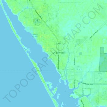
Name: Englewood topographic map, elevation, terrain.
Location: Englewood, Sarasota County, Florida, 34223, United States (26.91775 -82.40342 27.00477 -82.29851)
Average elevation: 10 ft
Minimum elevation: -16 ft
Maximum elevation: 36 ft
Sarasota County trails, hiking, mountain biking, running and outdoor activities