Geolocate

Ave Maria topographic map

Click on the map to display elevation.

Ave Maria

Ave Maria is 36 miles northeast of downtown Naples, Florida, and part of Collier County. The town's elevation is 18 feet. According to the United States Census Bureau, the city has a total area of 10.424sq mi (27.01km2).

Wikipedia (CC-BY-SA 3.0)

About this map

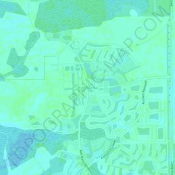
Name: Ave Maria topographic map, elevation, terrain.

Location: Ave Maria, Collier County, Florida, United States (26.31667 -81.45806 26.35667 -81.41806)

Average elevation: 26 ft

Minimum elevation: 16 ft

Maximum elevation: 33 ft

Collier County trails, hiking, mountain biking, running and outdoor activities

Other topographic maps

Click on a map to view its topography, its elevation and its terrain.

Vineyards

United States > Florida > Collier County

Average elevation: 20 ft

Orangetree

United States > Florida > Collier County

Average elevation: 20 ft

Goodland

United States > Florida > Collier County

Average elevation: 7 ft

Naples Manor

United States > Florida > Collier County

Average elevation: 16 ft

Golden Gate

United States > Florida > Collier County

Average elevation: 16 ft

Pine Ridge

United States > Florida > Collier County

Average elevation: 23 ft

Ave Maria

United States > Florida > Collier County

Average elevation: 26 ft

Rock Creek

United States > Florida > Collier County > Naples

Average elevation: 16 ft

Baker Park

United States > Florida > Collier County > Naples

Average elevation: 16 ft

Gear up for your next adventure:

🕶️GPS Smartphone Mount - Secure mount for phone navigation
🛰️Satellite Messengers - Emergency SOS and two-way messaging for off-grid adventures
🧢Sun Protection Hats - Wide-brimmed and UPF-rated hats for high-altitude sun safety
🪑Portable Camp Table - Compact table for campsite meals
🔭Stargazing Telescopes - Perfect for camping in low-light pollution areas shown on maps

As an Amazon Associate, this site earns from qualifying purchases at no extra cost to you.