Geolocate

Ventanilla topographic map

Click on the map to display elevation.

About this map

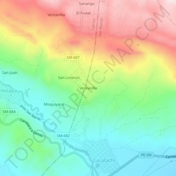
Name: Ventanilla topographic map, elevation, terrain.

Location: Ventanilla, Cacatachi, San Martín, 22170, Perú (-6.46713 -76.47366 -6.42713 -76.43366)

Average elevation: 1,545 ft

Minimum elevation: 886 ft

Maximum elevation: 2,536 ft

Gear up for your next adventure:

🌄Hiking Binoculars - Compact binoculars for scenic views and trail spotting
💧Water Purification System - Clean water on the trail with reliable purifiers
🔌USB Car Charger - Car charger for on‑the‑go power needs
🕶️Glacier Sunglasses - Side shields to protect eyes from high-altitude snow glare
🪶Wildlife Field Guides - Learn animal tracking and species ID

As an Amazon Associate, this site earns from qualifying purchases at no extra cost to you.