
Thank you for supporting this site ❤️
Make a donation
Make a donation
Gear up for your next adventure:
As an Amazon Associate, this site earns from qualifying purchases at no extra cost to you.
Mahabaleshwar topographic map
Click on the map to display elevation.
Thank you for supporting this site ❤️
Make a donation
Make a donation
Gear up for your next adventure:
As an Amazon Associate, this site earns from qualifying purchases at no extra cost to you.
About this map
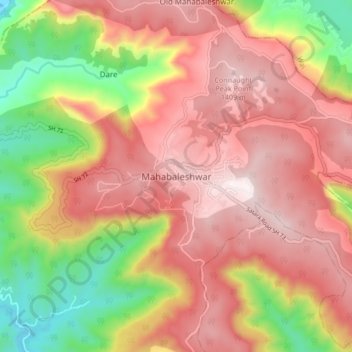
Name: Mahabaleshwar topographic map, elevation, terrain.
Location: Mahabaleshwar, Satara, Maharashtra, 412806, India (17.88428 73.61758 17.96428 73.69758)
Average elevation: 3,648 ft
Minimum elevation: 2,192 ft
Maximum elevation: 4,711 ft
Thank you for supporting this site ❤️
Make a donation
Make a donation
Gear up for your next adventure:
As an Amazon Associate, this site earns from qualifying purchases at no extra cost to you.