
Mull River topographic map
Interactive map
Click on the map to display elevation.
About this map
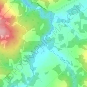
Name: Mull River topographic map, elevation, terrain.
Location: Mull River, Mabou, Nova Scotia, Canada (46.03371 -61.32477 46.03506 -61.32394)
Average elevation: 236 ft
Minimum elevation: 62 ft
Maximum elevation: 600 ft