
Thank you for supporting this site ❤️
Make a donation
Make a donation
Gear up for your next adventure:
As an Amazon Associate, this site earns from qualifying purchases at no extra cost to you.
Manolo topographic map
Click on the map to display elevation.
Thank you for supporting this site ❤️
Make a donation
Make a donation
Gear up for your next adventure:
As an Amazon Associate, this site earns from qualifying purchases at no extra cost to you.
About this map
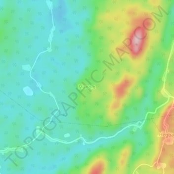
Name: Manolo topographic map, elevation, terrain.
Location: Manolo, Nguibassal, Nyong-et-Kéllé, Centre, Cameroon (3.97315 11.04174 4.01315 11.08174)
Average elevation: 1,460 ft
Minimum elevation: 1,230 ft
Maximum elevation: 2,011 ft
Thank you for supporting this site ❤️
Make a donation
Make a donation
Gear up for your next adventure:
As an Amazon Associate, this site earns from qualifying purchases at no extra cost to you.