Geolocate

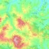
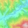
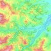
Sozzi topographic map

Click on the map to display elevation.

About this map

Name: Sozzi topographic map, elevation, terrain.

Location: Sozzi, Valmozzola, Parma, Emilia-Romagna, Italia (44.55073 9.83175 44.59073 9.87175)

Average elevation: 2,369 ft

Minimum elevation: 1,430 ft

Maximum elevation: 3,809 ft

Other topographic maps

Click on a map to view its topography, its elevation and its terrain.
Varano de' Melegari

Italia > Emilia-Romagna > Parma

Average elevation: 1,191 ft

Pellegrino Parmense

Italia > Emilia-Romagna > Parma

Average elevation: 1,417 ft

Compiano

Italia > Emilia-Romagna > Parma

Average elevation: 2,487 ft

Busseto

Italia > Emilia-Romagna > Parma

Average elevation: 154 ft

Fiume Taro

Italia > Emilia-Romagna > Parma > Copezzato

Average elevation: 115 ft

Torrente Baganza

Italia > Emilia-Romagna > Parma > Parma

Average elevation: 374 ft

Colorno

Italia > Emilia-Romagna > Parma

Average elevation: 95 ft

Soragna

Italia > Emilia-Romagna > Parma

Average elevation: 138 ft

Taro

Italia > Emilia-Romagna > Parma > Borgo Val di Taro

Average elevation: 2,293 ft

Gear up for your next adventure:

🌲Outdoor Survival Books - Best books on survival skills
🖼️Topo Map Wall Art - Decorative topographic prints of famous peaks and regions
🛡️Bear Spray Outdoor - Protection in bear country hikes
🧥Men's Rain Shells - Premium waterproof and breathable jackets for mountain weather
🧯Emergency Survival Kit - All‑in‑one survival essentials for the backcountry

As an Amazon Associate, this site earns from qualifying purchases at no extra cost to you.