Geolocate

Ravarano topographic map

Click on the map to display elevation.

About this map
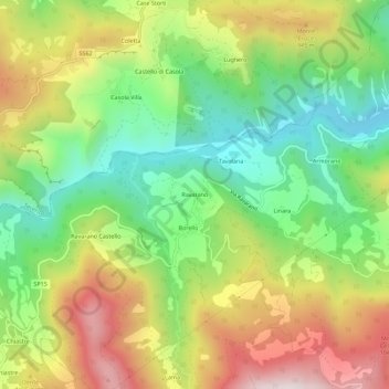
Name: Ravarano topographic map, elevation, terrain.

Location: Ravarano, Calestano, Parma, Emilia-Romagna, Italia (44.56078 10.05796 44.60078 10.09796)

Average elevation: 2,487 ft

Minimum elevation: 1,411 ft

Maximum elevation: 3,914 ft

Gear up for your next adventure:

📱Heavy-Duty Phone Cases - Drop-proof and waterproof protection for outdoor navigation
🔪Outdoor Multitools - Essential survival tools for gear repair and field use
🧢Sun Protection Hats - Wide-brimmed and UPF-rated hats for high-altitude sun safety
📻Weather Alert Radios - Stay informed of storm risks while off-the-grid
📚USA Hiking Guide Books - Top trail guides and map books

As an Amazon Associate, this site earns from qualifying purchases at no extra cost to you.