
Flores Island topographic map
Interactive map
Click on the map to display elevation.
About this map
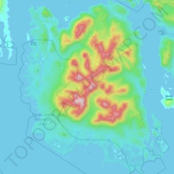
Name: Flores Island topographic map, elevation, terrain.
Average elevation: 423 ft
Minimum elevation: -3 ft
Maximum elevation: 2,838 ft
Other topographic maps
Click on a map to view its topography, its elevation and its terrain.
McCall Island
Canada > British Columbia > Alberni-Clayoquot Regional District > Area C (Long Beach)
McCall Island, Area C (Long Beach), Alberni-Clayoquot Regional District, British Columbia, Canada
Average elevation: 52 ft