
Cantarizu topographic map
Interactive map
Click on the map to display elevation.
About this map
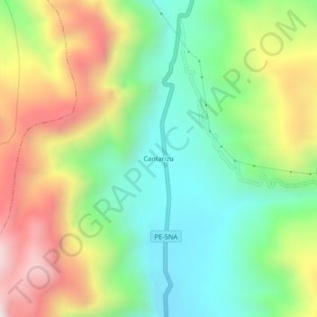
Name: Cantarizu topographic map, elevation, terrain.
Location: Cantarizu, Oxapampa, Pasco, Perú (-10.66427 -75.40832 -10.62427 -75.36832)
Average elevation: 6,893 ft
Minimum elevation: 5,620 ft
Maximum elevation: 8,839 ft
Other topographic maps
Click on a map to view its topography, its elevation and its terrain.
Llamaquizu
Perú > Pasco > Oxapampa > Miraflores
Llamaquizu, Miraflores, Oxapampa, Pasco, Perú
Average elevation: 6,358 ft
San Alberto
Perú > Pasco > Oxapampa > San Alberto
San Alberto, Oxapampa, Pasco, Perú
Average elevation: 6,319 ft