
Thank you for supporting this site ❤️
Make a donation
Make a donation
Gear up for your next adventure:
As an Amazon Associate, this site earns from qualifying purchases at no extra cost to you.
Llamaquizu topographic map
Click on the map to display elevation.
Thank you for supporting this site ❤️
Make a donation
Make a donation
Gear up for your next adventure:
As an Amazon Associate, this site earns from qualifying purchases at no extra cost to you.
About this map
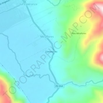
Name: Llamaquizu topographic map, elevation, terrain.
Location: Llamaquizu, Miraflores, Oxapampa, Pasco, Perú (-10.62253 -75.40216 -10.58253 -75.36216)
Average elevation: 6,358 ft
Minimum elevation: 5,909 ft
Maximum elevation: 8,156 ft
Thank you for supporting this site ❤️
Make a donation
Make a donation
Gear up for your next adventure:
As an Amazon Associate, this site earns from qualifying purchases at no extra cost to you.