Geolocate

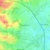
Great Wakering topographic map

Click on the map to display elevation.

About this map

Name: Great Wakering topographic map, elevation, terrain.

Location: Great Wakering, Rochford, Essex, England, United Kingdom (51.50915 0.75155 51.57713 0.88997)

Average elevation: 3 ft

Minimum elevation: -13 ft

Maximum elevation: 43 ft

Other topographic maps

Click on a map to view its topography, its elevation and its terrain.

Rayleigh Mount

United Kingdom > England > Essex > Rochford > Rayleigh

Average elevation: 164 ft

Stroud Green

United Kingdom > England > Essex > Rochford

Average elevation: 72 ft

Gear up for your next adventure:

🦶Hiking Gaiters - Keep debris and water out of your boots
🪶Multi‑Purpose Knife - Useful blade for camp and trail
🔪Outdoor Multitools - Essential survival tools for gear repair and field use
📦Dry Bags Set - Waterproof storage for electronics and clothes
🛠️Outdoor Gear Repair Kit - Essential tools to fix gear on the trail

As an Amazon Associate, this site earns from qualifying purchases at no extra cost to you.