Geolocate

Cigoitia topographic map

Click on the map to display elevation.

About this map

Name: Cigoitia topographic map, elevation, terrain.

Location: Cigoitia, Estribaciones del Gorbea, Álava, País Vasco, 01138, España (42.90221 -2.78885 43.03419 -2.67684)

Average elevation: 2,274 ft

Minimum elevation: 1,677 ft

Maximum elevation: 4,849 ft

Other topographic maps

Click on a map to view its topography, its elevation and its terrain.
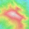
Gorbeia

España > País Vasco > Estribaciones del Gorbea > Ceánuri

El monte Gorbea (en euskera: Gorbeia) es la cumbre más alta del macizo montañoso del mismo nombre, situado en los Montes Vascos, a caballo entre las provincias de Álava y Vizcaya, en el País Vasco (España). Tiene una altitud de 1482 metros sobre el nivel del mar y su cima está coronada desde 1899 por una…

Average elevation: 3,901 ft

Altube

España > País Vasco > Estribaciones del Gorbea

Average elevation: 1,755 ft

Arleaga

España > País Vasco > Estribaciones del Gorbea

Average elevation: 2,201 ft

Nafarrate

España > País Vasco > Estribaciones del Gorbea

Average elevation: 1,886 ft

Marquina

España > País Vasco > Estribaciones del Gorbea

Average elevation: 2,362 ft

Gear up for your next adventure:

💧Water Purification System - Clean water on the trail with reliable purifiers
🧴Hand Sanitizer - Keep hands clean while hiking
😴Insulated Sleeping Pads - Compact and warm pads for high-elevation camping
🧥Men's Rain Shells - Premium waterproof and breathable jackets for mountain weather
📱Solar Portable Charger - Solar power bank for charging devices off‑grid

As an Amazon Associate, this site earns from qualifying purchases at no extra cost to you.