
Milngavie topographic map
Click on the map to display elevation.
About this map
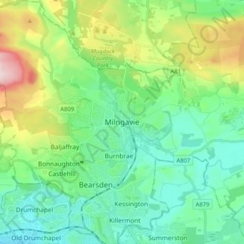
Name: Milngavie topographic map, elevation, terrain.
Average elevation: 325 ft
Minimum elevation: 26 ft
Maximum elevation: 1,142 ft
Other topographic maps
Click on a map to view its topography, its elevation and its terrain.
River Kelvin
United Kingdom > Scotland > East Dunbartonshire > Kirkintilloch
Average elevation: 377 ft
Craigmaddie Reservoir
United Kingdom > Scotland > East Dunbartonshire > Milngavie
Average elevation: 318 ft