Geolocate

Villeta topographic map

Click on the map to display elevation.

About this map
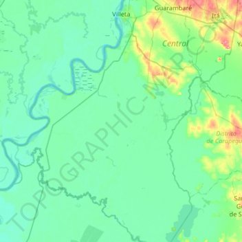
Name: Villeta topographic map, elevation, terrain.

Location: Villeta, Central Department, Región Oriental, Paraguay (-25.95255 -57.82741 -25.47746 -57.41305)

Average elevation: 233 ft

Minimum elevation: 148 ft

Maximum elevation: 764 ft

Gear up for your next adventure:

🕶️GPS Smartphone Mount - Secure mount for phone navigation
🎒Waterproof Dry Bags - Keep your electronics and maps dry inside your pack
🚪Portable Camp Chair - Foldable chair for comfort at camp
⛺Backpacking Tents - Weight-optimized shelters for multi-day topographic surveys
🪶Compact Camp Shovel - Folding shovel for campsite tasks

As an Amazon Associate, this site earns from qualifying purchases at no extra cost to you.