
Thank you for supporting this site ❤️
Make a donation
Make a donation
Gear up for your next adventure:
As an Amazon Associate, this site earns from qualifying purchases at no extra cost to you.
Gittana topographic map
Click on the map to display elevation.
Thank you for supporting this site ❤️
Make a donation
Make a donation
Gear up for your next adventure:
As an Amazon Associate, this site earns from qualifying purchases at no extra cost to you.
About this map
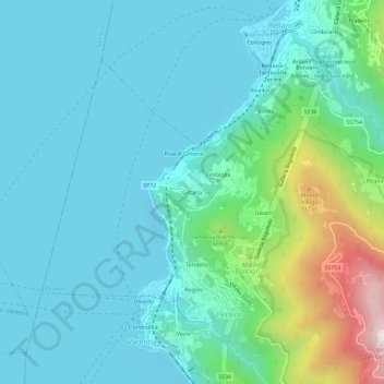
Name: Gittana topographic map, elevation, terrain.
Location: Gittana, Bologna, Perledo, Lecco, Lombardia, 23828, Italia (46.00557 9.27066 46.04557 9.31066)
Average elevation: 1,260 ft
Minimum elevation: 584 ft
Maximum elevation: 4,193 ft
Thank you for supporting this site ❤️
Make a donation
Make a donation
Gear up for your next adventure:
As an Amazon Associate, this site earns from qualifying purchases at no extra cost to you.