Geolocate

Ralph topographic map

Click on the map to display elevation.

👉 Easily get elevation data in JSON, GeoTIFF and KML formats using Elevation API
Thank you for supporting this site ❤️
Make a donation

About this map

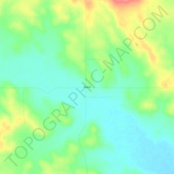
Name: Ralph topographic map, elevation, terrain.

Location: Ralph, Harding County, South Dakota, 57650, United States (45.75667 -103.08600 45.79667 -103.04600)

Average elevation: 2,776 ft

Minimum elevation: 2,680 ft

Maximum elevation: 2,956 ft

South Dakota trails, hiking, mountain biking, running and outdoor activities

Gear up for your next adventure:

Solar GPS Watches - Advanced multisport watches with built-in topographic maps
🧤Hiking Gloves - Protective gloves for rugged trails
🧭Outdoor Navigation Book - Learn advanced navigation skills
🌐World Map Poster - Decorative world maps with topographic info
🔭Stargazing Telescopes - Perfect for camping in low-light pollution areas shown on maps

As an Amazon Associate, this site earns from qualifying purchases at no extra cost to you.