
Make a donation
Gear up for your next adventure:
As an Amazon Associate, this site earns from qualifying purchases at no extra cost to you.
Whiting Mountain topographic map
Click on the map to display elevation.
Make a donation
Gear up for your next adventure:
As an Amazon Associate, this site earns from qualifying purchases at no extra cost to you.
About this map
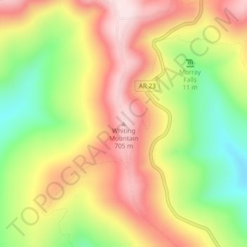
Name: Whiting Mountain topographic map, elevation, terrain.
Location: Whiting Mountain, Franklin County, Arkansas, United States (35.73670 -93.81691 35.73680 -93.81681)
Average elevation: 1,768 ft
Minimum elevation: 1,122 ft
Maximum elevation: 2,339 ft
Make a donation
Gear up for your next adventure:
As an Amazon Associate, this site earns from qualifying purchases at no extra cost to you.
Other topographic maps
Click on a map to view its topography, its elevation and its terrain.
Altus
United States > Arkansas > Franklin County > Altus
Altus had its start in 1875 when the railroad was extended to that point. Altus station was the highest point on the track. In recognition of this highest railroad elevation between Little Rock and Fort Smith, the station was originally known as "Summit". The town's initial development was due to railroad…
Average elevation: 630 ft