
Djebel Zendel topographic map
Interactive map
Click on the map to display elevation.
About this map
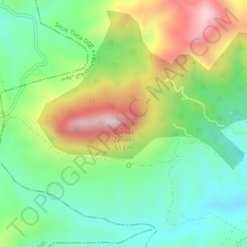
Name: Djebel Zendel topographic map, elevation, terrain.
Location: Djebel Zendel, Souk Tlata, Daïra Bab El Assa, Tlemcen, Algérie (35.02999 -2.02715 35.03009 -2.02705)
Average elevation: 951 ft
Minimum elevation: 348 ft
Maximum elevation: 1,972 ft
Other topographic maps
Click on a map to view its topography, its elevation and its terrain.
Ouled Benayad
Algérie > Tlemcen > Daïra Bab El Assa > Souk Tlata > Ouled Benayad
Ouled Benayad, Souk Tlata, Daïra Bab El Assa, Tlemcen, Algérie
Average elevation: 299 ft