
Pampachiri topographic map
Interactive map
Click on the map to display elevation.
About this map
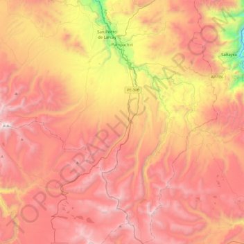
Name: Pampachiri topographic map, elevation, terrain.
Location: Pampachiri, Provincia de Andahuaylas, Apurímac, Perú (-14.54431 -73.58663 -14.10734 -73.36877)
Average elevation: 13,501 ft
Minimum elevation: 8,829 ft
Maximum elevation: 16,699 ft
Other topographic maps
Click on a map to view its topography, its elevation and its terrain.
Occobamba
Perú > Apurímac > Pampachiri
Occobamba, Pampachiri, Andahuaylas, Apurímac, Perú
Average elevation: 12,008 ft