Geolocate

Occobamba topographic map

Click on the map to display elevation.

About this map

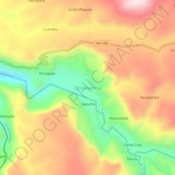
Name: Occobamba topographic map, elevation, terrain.

Location: Occobamba, Pampachiri, Andahuaylas, Apurímac, Perú (-14.25104 -73.51978 -14.21104 -73.47978)

Average elevation: 12,008 ft

Minimum elevation: 11,122 ft

Maximum elevation: 12,782 ft

Gear up for your next adventure:

👟Men's Trail Runners - Lightweight footwear for fast-paced exploration and light hiking
🥇GPS Hiking Watch - Multi‑sport GPS watch with navigation and trail tracking
💧Water Filtration Bottles - Safely drink from streams and lakes while exploring
🕶️GPS Smartphone Mount - Secure mount for phone navigation
🛰️Handheld GPS Units - Professional satellite navigators for precise backcountry mapping

As an Amazon Associate, this site earns from qualifying purchases at no extra cost to you.