Geolocate

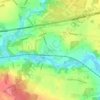
Skibelund topographic map

Click on the map to display elevation.

About this map

Name: Skibelund topographic map, elevation, terrain.

Location: Skibelund, Kolding, Kolding Kommune, Region Syddanmark, 6092, Danmark (55.41637 9.61984 55.45637 9.65984)

Average elevation: 7 ft

Minimum elevation: -20 ft

Maximum elevation: 69 ft

Other topographic maps

Click on a map to view its topography, its elevation and its terrain.
Ejstrup

Danmark > Region Syddanmark > Kolding

Average elevation: 112 ft

Agtrupvig

Danmark > Region Syddanmark > Kolding

Average elevation: 62 ft

Gear up for your next adventure:

🪶Trail Camera - Capture wildlife on your hikes
🥩Freeze-Dried Meals - Nutritious and lightweight food for remote expeditions
🧦Hiking Socks - Comfortable socks to prevent blisters on long hikes
📚USA Hiking Guide Books - Top trail guides and map books
🥤Water Filter Bottle - All‑in‑one filter bottle for safe hydration

As an Amazon Associate, this site earns from qualifying purchases at no extra cost to you.