
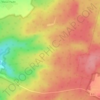
La Vendue topographic map
Interactive map
Click on the map to display elevation.
About this map
Name: La Vendue topographic map, elevation, terrain.
Average elevation: 1,230 ft
Minimum elevation: 1,027 ft
Maximum elevation: 1,332 ft
Other topographic maps
Click on a map to view its topography, its elevation and its terrain.
Sautreuil
France > Grand Est > Haute-Marne > Arc-en-Barrois
Sautreuil, Arc-en-Barrois, Chaumont, Haute-Marne, Grand Est, France métropolitaine, 52210, France
Average elevation: 1,253 ft
La Petite Forêt
France > Grand Est > Haute-Marne > Arc-en-Barrois
La Petite Forêt, Arc-en-Barrois, Chaumont, Haute-Marne, Grand Est, France métropolitaine, 52210, France
Average elevation: 1,010 ft
Montrot
France > Grand Est > Haute-Marne > Arc-en-Barrois
Montrot, Arc-en-Barrois, Chaumont, Haute-Marne, Grand Est, France métropolitaine, 52210, France
Average elevation: 1,135 ft