Geolocate

Montrot topographic map

Click on the map to display elevation.

About this map
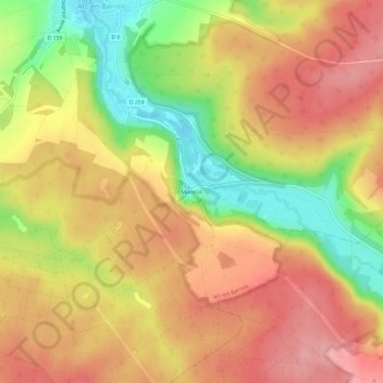
Name: Montrot topographic map, elevation, terrain.

Location: Montrot, Arc-en-Barrois, Chaumont, Haute-Marne, Grand Est, France métropolitaine, 52210, France (47.90879 5.00169 47.94879 5.04169)

Average elevation: 1,135 ft

Minimum elevation: 883 ft

Maximum elevation: 1,312 ft

Other topographic maps

Click on a map to view its topography, its elevation and its terrain.

52210

France > Grand Est > Haute-Marne > Arc-en-Barrois

Average elevation: 1,194 ft

Gear up for your next adventure:

🚁Photography Drones - Capture stunning aerial views of landforms and topography
🪶LED Camping Lantern - Bright lantern for camp lighting
🧭Orienteering Set - Complete compass and map reading kit
🔦LED Headlamp - Bright and durable LED headlamp for night navigation
🧺Microfiber Travel Towels - Compact and fast-drying towels for trail use

As an Amazon Associate, this site earns from qualifying purchases at no extra cost to you.