
Thank you for supporting this site ❤️
Make a donation
Make a donation
Gear up for your next adventure:
As an Amazon Associate, this site earns from qualifying purchases at no extra cost to you.
Natividad topographic map
Click on the map to display elevation.
Thank you for supporting this site ❤️
Make a donation
Make a donation
Gear up for your next adventure:
As an Amazon Associate, this site earns from qualifying purchases at no extra cost to you.
About this map
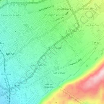
Name: Natividad topographic map, elevation, terrain.
Location: Natividad, Tacna, Provincia de Tacna, Tacna, 23003, Perú (-18.03311 -70.25400 -17.99311 -70.21400)
Average elevation: 2,064 ft
Minimum elevation: 1,732 ft
Maximum elevation: 2,779 ft
Thank you for supporting this site ❤️
Make a donation
Make a donation
Gear up for your next adventure:
As an Amazon Associate, this site earns from qualifying purchases at no extra cost to you.