Geolocate

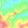
Guardinha topographic map

Click on the map to display elevation.

About this map

Name: Guardinha topographic map, elevation, terrain.

Location: Guardinha, São Sebastião do Paraíso, Minas Gerais, Região Sudeste, Brasil (-20.98380 -47.24000 -20.85544 -47.08646)

Average elevation: 2,838 ft

Minimum elevation: 2,415 ft

Maximum elevation: 3,832 ft

Other topographic maps

Click on a map to view its topography, its elevation and its terrain.

Antinha

Brasil > Minas Gerais > São Sebastião do Paraíso

Average elevation: 2,795 ft

lagoinha

Brasil > Minas Gerais > São Sebastião do Paraíso

Average elevation: 3,136 ft

Gear up for your next adventure:

🏫Relief Map Kits - Hands-on tools for teaching landforms and elevation
💧Water Filtration Bottles - Safely drink from streams and lakes while exploring
☕Camping Coffee Makers - Enjoy premium coffee at the summit or campsite
🧣Hiking Neck Gaiter - Multi‑use neck protection for outdoor weather
☀️Outdoor Sunscreen - High protection sunscreen for outdoor activities

As an Amazon Associate, this site earns from qualifying purchases at no extra cost to you.