Geolocate

Victoria topographic map

Click on the map to display elevation.

About this map

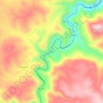
Name: Victoria topographic map, elevation, terrain.

Location: Victoria, Lawrence County, South Dakota, United States (44.37498 -103.92771 44.41498 -103.88771)

Average elevation: 5,197 ft

Minimum elevation: 4,259 ft

Maximum elevation: 5,863 ft

South Dakota trails, hiking, mountain biking, running and outdoor activities

Gear up for your next adventure:

🌲Outdoor Survival Books - Best books on survival skills
🗻Climbing Gear Basics - Essential gear for beginner climbers
🛰️Handheld GPS Units - Professional satellite navigators for precise backcountry mapping
🧥Waterproof Jacket for Hiking - Breathable and rugged rain jacket for outdoor excursions
🪶Camp Gear Gift Set - Perfect gift bundle for outdoor fans

As an Amazon Associate, this site earns from qualifying purchases at no extra cost to you.