
Thank you for supporting this site ❤️
Make a donation
Make a donation
Gear up for your next adventure:
As an Amazon Associate, this site earns from qualifying purchases at no extra cost to you.
Lago di Corbara topographic map
Click on the map to display elevation.
Thank you for supporting this site ❤️
Make a donation
Make a donation
Gear up for your next adventure:
As an Amazon Associate, this site earns from qualifying purchases at no extra cost to you.
About this map
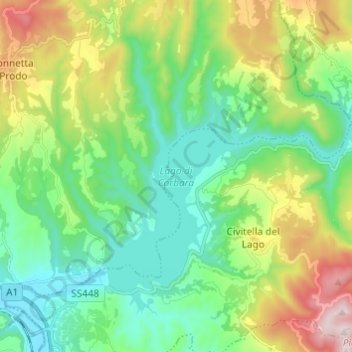
Name: Lago di Corbara topographic map, elevation, terrain.
Location: Lago di Corbara, Baschi, Terni, Umbria, 05023, Italia (42.69206 12.22970 42.76284 12.35094)
Average elevation: 1,053 ft
Minimum elevation: 302 ft
Maximum elevation: 2,805 ft
Thank you for supporting this site ❤️
Make a donation
Make a donation
Gear up for your next adventure:
As an Amazon Associate, this site earns from qualifying purchases at no extra cost to you.