Geolocate

Kalanganyar topographic map

Click on the map to display elevation.

About this map

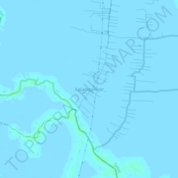
Name: Kalanganyar topographic map, elevation, terrain.

Location: Kalanganyar, Sedati, Sidoarjo, East Java, Java, Indonesia (-7.45825 112.79181 -7.41825 112.83181)

Average elevation: 0 ft

Minimum elevation: -10 ft

Maximum elevation: 20 ft

Other topographic maps

Click on a map to view its topography, its elevation and its terrain.

Prambon

Indonesia > East Java > Sidoarjo

Average elevation: 43 ft

Krembung

Indonesia > East Java > Sidoarjo

Average elevation: 33 ft

Tanggulangin

Indonesia > East Java > Sidoarjo

Average elevation: 10 ft

Tulangan

Indonesia > East Java > Sidoarjo

Average elevation: 26 ft

Gear up for your next adventure:

🔦LED Headlamp - Bright and durable LED headlamp for night navigation
🗻Climbing Gear Basics - Essential gear for beginner climbers
🚪Portable Camp Chair - Foldable chair for comfort at camp
🧢Outdoor Hiking Hat - Sun protection hat for outdoor explorers
🛡️Bear Spray Outdoor - Protection in bear country hikes

As an Amazon Associate, this site earns from qualifying purchases at no extra cost to you.