
Thank you for supporting this site ❤️
Make a donation
Make a donation
Gear up for your next adventure:
As an Amazon Associate, this site earns from qualifying purchases at no extra cost to you.
Bagru topographic map
Click on the map to display elevation.
Thank you for supporting this site ❤️
Make a donation
Make a donation
Gear up for your next adventure:
As an Amazon Associate, this site earns from qualifying purchases at no extra cost to you.
About this map
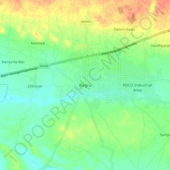
Name: Bagru topographic map, elevation, terrain.
Location: Bagru, Sanganer Tehsil, Jaipur, Rajasthan, 303007, India (26.76880 75.50231 26.84880 75.58231)
Average elevation: 1,178 ft
Minimum elevation: 1,115 ft
Maximum elevation: 1,280 ft
Thank you for supporting this site ❤️
Make a donation
Make a donation
Gear up for your next adventure:
As an Amazon Associate, this site earns from qualifying purchases at no extra cost to you.