
Thank you for supporting this site ❤️
Make a donation
Make a donation
Gear up for your next adventure:
As an Amazon Associate, this site earns from qualifying purchases at no extra cost to you.
Mainhausen topographic map
Click on the map to display elevation.
Thank you for supporting this site ❤️
Make a donation
Make a donation
Gear up for your next adventure:
As an Amazon Associate, this site earns from qualifying purchases at no extra cost to you.
About this map
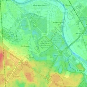
Name: Mainhausen topographic map, elevation, terrain.
Location: Mainhausen, Landkreis Offenbach, Hessen, 63533, Deutschland (49.98799 8.96934 50.04385 9.05137)
Average elevation: 384 ft
Minimum elevation: 325 ft
Maximum elevation: 486 ft
Thank you for supporting this site ❤️
Make a donation
Make a donation
Gear up for your next adventure:
As an Amazon Associate, this site earns from qualifying purchases at no extra cost to you.