Geolocate

Tacana topographic map

Click on the map to display elevation.

About this map

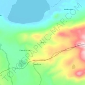
Name: Tacana topographic map, elevation, terrain.

Location: Tacana, Oropesa, Antabamba, Apurímac, Perú (-14.68629 -72.56493 -14.64629 -72.52493)

Average elevation: 15,614 ft

Minimum elevation: 15,161 ft

Maximum elevation: 16,486 ft

Gear up for your next adventure:

⛑️Personal Locator Beacon - Safety beacon for emergencies
🥤Water Filter Bottle - All‑in‑one filter bottle for safe hydration
🚑Emergency Bivvies - Heat-reflective sleeping bags for survival situations
🧥Waterproof Jacket for Hiking - Breathable and rugged rain jacket for outdoor excursions
🏕️Tent Footprint - Protect your tent base from wear

As an Amazon Associate, this site earns from qualifying purchases at no extra cost to you.