
Make a donation
Gear up for your next adventure:
As an Amazon Associate, this site earns from qualifying purchases at no extra cost to you.
Rome City topographic map
Click on the map to display elevation.
Make a donation
Gear up for your next adventure:
As an Amazon Associate, this site earns from qualifying purchases at no extra cost to you.
About this map
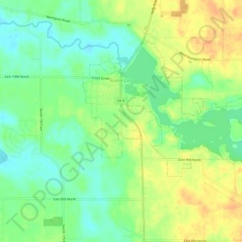
Name: Rome City topographic map, elevation, terrain.
Location: Rome City, Noble County, Indiana, 46784, United States (41.47441 -85.38575 41.50328 -85.32775)
Average elevation: 928 ft
Minimum elevation: 873 ft
Maximum elevation: 991 ft
Noble County trails, hiking, mountain biking, running and outdoor activities
Make a donation
Gear up for your next adventure:
As an Amazon Associate, this site earns from qualifying purchases at no extra cost to you.
Other topographic maps
Click on a map to view its topography, its elevation and its terrain.
Kendallville
United States > Indiana > Noble County > Kendallville > Kendallville
Average elevation: 997 ft