Geolocate

Evenwood topographic map

Click on the map to display elevation.

About this map

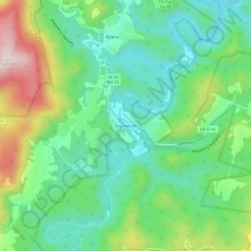
Name: Evenwood topographic map, elevation, terrain.

Location: Evenwood, Randolph County, West Virginia, 26254, United States (38.87567 -79.66839 38.91567 -79.62839)

Average elevation: 2,946 ft

Minimum elevation: 2,530 ft

Maximum elevation: 3,812 ft

Other topographic maps

Click on a map to view its topography, its elevation and its terrain.

Elkins

United States > West Virginia > Randolph County

Elkins is located at the confluence of the Tygart Valley River and Leading Creek. The average elevation is 2,000 feet (610 m) above sea level. According to the United States Census Bureau, the city has a total area of 3.43 square miles (8.88 km2), all land. Elkins is headquarters for the Monongahela National…

Average elevation: 2,090 ft

Huttonsville

United States > West Virginia > Randolph County

Average elevation: 2,169 ft

Harman

United States > West Virginia > Randolph County

Average elevation: 2,671 ft

Mill Creek

United States > West Virginia > Randolph County

Average elevation: 2,136 ft

Spruce Knob Lake

United States > West Virginia > Randolph County

Spruce Knob Lake is a 23-acre (0.093 km2) reservoir located within the Monongahela National Forest in Randolph County, West Virginia, USA. The recreation area surrounding Spruce Knob Lake contains camping and picnicking facilities as well as a boating site. At an elevation of 3,840 feet, it is the highest lake…

Average elevation: 3,950 ft

Elkins

United States > West Virginia > Randolph County

Elkins is located at the confluence of the Tygart Valley River and Leading Creek. The average elevation is 2,000 feet (610 m) above sea level. According to the United States Census Bureau, the city has a total area of 3.43 square miles (8.88 km2), all land. Elkins is headquarters for the Monongahela National…

Average elevation: 2,090 ft

Gear up for your next adventure:

👟Men's Trail Runners - Lightweight footwear for fast-paced exploration and light hiking
👖Convertible Hiking Pants - Versatile zip-off pants for changing altitudes and temperatures
🏔️Mountain Trail Maps - High‑detail maps for popular peaks
🖼️Topo Map Wall Art - Decorative topographic prints of famous peaks and regions
GPS Sports Watch - GPS watch for running, hiking and training

As an Amazon Associate, this site earns from qualifying purchases at no extra cost to you.