
Make a donation
Gear up for your next adventure:
As an Amazon Associate, this site earns from qualifying purchases at no extra cost to you.
St. Peter topographic map
Click on the map to display elevation.
Make a donation
Gear up for your next adventure:
As an Amazon Associate, this site earns from qualifying purchases at no extra cost to you.
About this map
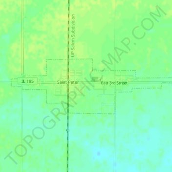
Name: St. Peter topographic map, elevation, terrain.
Location: St. Peter, Fayette County, Illinois, 62880, United States (38.86306 -88.86541 38.87173 -88.83236)
Average elevation: 587 ft
Minimum elevation: 561 ft
Maximum elevation: 607 ft
Fayette County trails, hiking, mountain biking, running and outdoor activities
Make a donation
Gear up for your next adventure:
As an Amazon Associate, this site earns from qualifying purchases at no extra cost to you.
Other topographic maps
Click on a map to view its topography, its elevation and its terrain.
Carlyle Lake State Wildlife Management Area
United States > Illinois > Fayette County
Average elevation: 443 ft