Geolocate

The Highlands topographic map

Click on the map to display elevation.

About this map

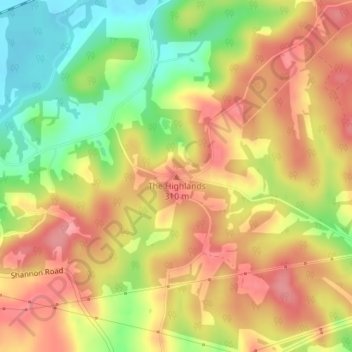
Name: The Highlands topographic map, elevation, terrain.

Location: The Highlands, Muskingum County, Ohio, United States (40.10835 -82.08797 40.10845 -82.08787)

Average elevation: 915 ft

Minimum elevation: 725 ft

Maximum elevation: 1,056 ft

Other topographic maps

Click on a map to view its topography, its elevation and its terrain.

Zanesville

United States > Ohio > Muskingum County

Average elevation: 833 ft

Philo

United States > Ohio > Muskingum County

Average elevation: 774 ft

Zanesville

United States > Ohio > Muskingum County

Average elevation: 833 ft

Zanesville

United States > Ohio > Muskingum County

Average elevation: 833 ft

Roseville

United States > Ohio > Muskingum County

Average elevation: 801 ft

Adamsville

United States > Ohio > Muskingum County

Average elevation: 958 ft

Zanesville

United States > Ohio > Muskingum County

Average elevation: 833 ft

Zanesville

United States > Ohio > Muskingum County

Average elevation: 833 ft

Frazeysburg

United States > Ohio > Muskingum County

Average elevation: 764 ft

Dresden

United States > Ohio > Muskingum County

The median elevation of Dresden is 741 feet (226 m).

Average elevation: 771 ft

Gear up for your next adventure:

🔦LED Headlamp - Bright and durable LED headlamp for night navigation
🧯Portable Fire Pit - Compact fire pit for camping spots
🔌Solar Panel Charger - Charge gear sustainably outdoors
🧥Waterproof Jacket for Hiking - Breathable and rugged rain jacket for outdoor excursions
🧭Orienteering Set - Complete compass and map reading kit

As an Amazon Associate, this site earns from qualifying purchases at no extra cost to you.