
Thank you for supporting this site ❤️
Make a donation
Make a donation
Gear up for your next adventure:
As an Amazon Associate, this site earns from qualifying purchases at no extra cost to you.
Jassur topographic map
Click on the map to display elevation.
Thank you for supporting this site ❤️
Make a donation
Make a donation
Gear up for your next adventure:
As an Amazon Associate, this site earns from qualifying purchases at no extra cost to you.
About this map
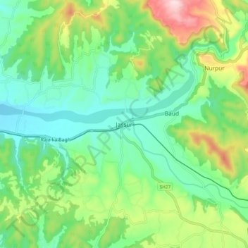
Name: Jassur topographic map, elevation, terrain.
Location: Jassur, Nurpur, Kangra, Himachal Pradesh, 176201, India (32.24162 75.80945 32.32162 75.88945)
Average elevation: 1,660 ft
Minimum elevation: 1,329 ft
Maximum elevation: 2,392 ft
Thank you for supporting this site ❤️
Make a donation
Make a donation
Gear up for your next adventure:
As an Amazon Associate, this site earns from qualifying purchases at no extra cost to you.