
Thank you for supporting this site ❤️
Make a donation
Make a donation
Gear up for your next adventure:
As an Amazon Associate, this site earns from qualifying purchases at no extra cost to you.
Mulinaccio topographic map
Click on the map to display elevation.
Thank you for supporting this site ❤️
Make a donation
Make a donation
Gear up for your next adventure:
As an Amazon Associate, this site earns from qualifying purchases at no extra cost to you.
About this map
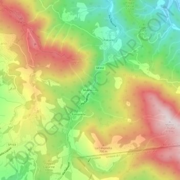
Name: Mulinaccio topographic map, elevation, terrain.
Location: Mulinaccio, Vaglia, Firenze, Toscana, 50036, Italia (43.86499 11.33045 43.90499 11.37045)
Average elevation: 1,877 ft
Minimum elevation: 866 ft
Maximum elevation: 2,953 ft
Thank you for supporting this site ❤️
Make a donation
Make a donation
Gear up for your next adventure:
As an Amazon Associate, this site earns from qualifying purchases at no extra cost to you.