
Thank you for supporting this site ❤️
Make a donation
Make a donation
Gear up for your next adventure:
As an Amazon Associate, this site earns from qualifying purchases at no extra cost to you.
Dalanjargalan topographic map
Click on the map to display elevation.
Thank you for supporting this site ❤️
Make a donation
Make a donation
Gear up for your next adventure:
As an Amazon Associate, this site earns from qualifying purchases at no extra cost to you.
About this map
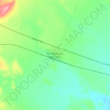
Name: Dalanjargalan topographic map, elevation, terrain.
Location: Dalanjargalan, Dornogovi, Mongolia (45.88099 109.02585 45.96099 109.10585)
Average elevation: 3,632 ft
Minimum elevation: 3,517 ft
Maximum elevation: 3,911 ft
Thank you for supporting this site ❤️
Make a donation
Make a donation
Gear up for your next adventure:
As an Amazon Associate, this site earns from qualifying purchases at no extra cost to you.