Geolocate

Huacan topographic map

Click on the map to display elevation.

About this map

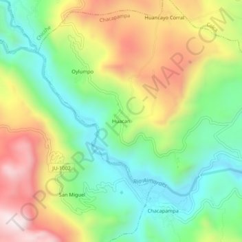
Name: Huacan topographic map, elevation, terrain.

Location: Huacan, Chacapampa, Huancayo, Junín, Perú (-12.35047 -75.27445 -12.31047 -75.23445)

Average elevation: 11,837 ft

Minimum elevation: 10,869 ft

Maximum elevation: 13,215 ft

Gear up for your next adventure:

🔦Compact Flashlight - Reliable flashlight for emergencies
🧭GPS Watch Accessories - Bands and chargers for GPS watches
🥤Water Filter Bottle - All‑in‑one filter bottle for safe hydration
🛶Inflatable Kayak - Portable kayak for rivers, lakes, and expeditions
🧢Outdoor Hiking Hat - Sun protection hat for outdoor explorers

As an Amazon Associate, this site earns from qualifying purchases at no extra cost to you.