Geolocate

Peru topographic map

Click on the map to display elevation.

About this map

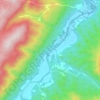
Name: Peru topographic map, elevation, terrain.

Location: Peru, Hardy County, West Virginia, 26838, United States (38.82112 -79.09416 38.86112 -79.05416)

Average elevation: 1,729 ft

Minimum elevation: 1,076 ft

Maximum elevation: 2,884 ft

Hardy County trails, hiking, mountain biking, running and outdoor activities

Other topographic maps

Click on a map to view its topography, its elevation and its terrain.

Lost River

United States > West Virginia > Hardy County

Average elevation: 1,522 ft

Gear up for your next adventure:

🖼️Topo Map Wall Art - Decorative topographic prints of famous peaks and regions
🧤Hiking Gloves - Protective gloves for rugged trails
🧺Microfiber Travel Towels - Compact and fast-drying towels for trail use
🗺️NatGeo Topo Maps - High-quality waterproof printed topographic maps of US Parks
🧣Hiking Neck Gaiter - Multi‑use neck protection for outdoor weather

As an Amazon Associate, this site earns from qualifying purchases at no extra cost to you.