
Thank you for supporting this site ❤️
Make a donation
Make a donation
Gear up for your next adventure:
As an Amazon Associate, this site earns from qualifying purchases at no extra cost to you.
Rukullacta topographic map
Click on the map to display elevation.
Thank you for supporting this site ❤️
Make a donation
Make a donation
Gear up for your next adventure:
As an Amazon Associate, this site earns from qualifying purchases at no extra cost to you.
About this map
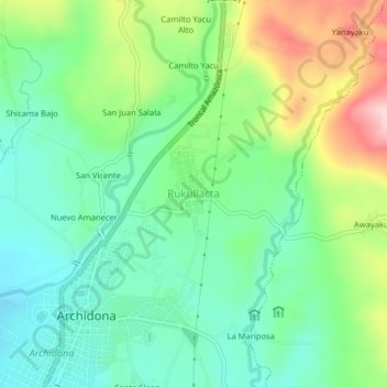
Name: Rukullacta topographic map, elevation, terrain.
Location: Rukullacta, Archidona, Napo, 150103, Ecuador (-0.89621 -77.79601 -0.89611 -77.79591)
Average elevation: 2,008 ft
Minimum elevation: 1,827 ft
Maximum elevation: 2,349 ft
Thank you for supporting this site ❤️
Make a donation
Make a donation
Gear up for your next adventure:
As an Amazon Associate, this site earns from qualifying purchases at no extra cost to you.