Hull topographic map
Interactive map
Click on the map to display elevation.
About this map
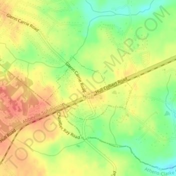
Name: Hull topographic map, elevation, terrain.
Location: Hull, Madison County, Georgia, United States (34.01131 -83.30165 34.02108 -83.28560)
Average elevation: 784 ft
Minimum elevation: 686 ft
Maximum elevation: 856 ft
Other topographic maps
Click on a map to view its topography, its elevation and its terrain.
Danielsville
United States > Georgia > Madison County
Danielsville, Madison County, Georgia, United States
Average elevation: 719 ft
Dogsboro
United States > Georgia > Madison County
Dogsboro, Madison County, Georgia, 30646, United States
Average elevation: 807 ft
Comer
United States > Georgia > Madison County
Comer, Madison County, Georgia, United States
Average elevation: 666 ft
Morgantown Baptist Association Dam
United States > Georgia > Madison County
Morgantown Baptist Association Dam, Madison County, Georgia, 30633, United States
Average elevation: 738 ft