Geolocate

Morrope topographic map

Click on the map to display elevation.

About this map

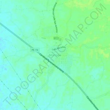
Name: Morrope topographic map, elevation, terrain.

Location: Morrope, Mórrope, Province of Lambayeque, Lambayeque, Peru (-6.56039 -80.03536 -6.52039 -79.99536)

Average elevation: 62 ft

Minimum elevation: 46 ft

Maximum elevation: 79 ft

Gear up for your next adventure:

🕶️GPS Smartphone Mount - Secure mount for phone navigation
🪑Ultralight Camp Chairs - Portable seating for resting after a long day of mapping
👓Polarized Sunglasses - Outdoor sunglasses for glare reduction
🌄Hiking Binoculars - Compact binoculars for scenic views and trail spotting
🥘Titanium Cookware - Durable, featherlight pots and pans for backpacking

As an Amazon Associate, this site earns from qualifying purchases at no extra cost to you.