
Thank you for supporting this site ❤️
Make a donation
Make a donation
Gear up for your next adventure:
As an Amazon Associate, this site earns from qualifying purchases at no extra cost to you.
Sebseb topographic map
Click on the map to display elevation.
Thank you for supporting this site ❤️
Make a donation
Make a donation
Gear up for your next adventure:
As an Amazon Associate, this site earns from qualifying purchases at no extra cost to you.
About this map
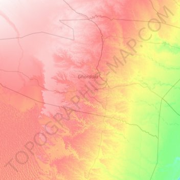
Name: Sebseb topographic map, elevation, terrain.
Location: Sebseb, Metlili Châamba District, Ghardaia, 47025, Algeria (31.79838 2.23994 32.80405 4.43338)
Average elevation: 1,686 ft
Minimum elevation: 679 ft
Maximum elevation: 2,831 ft
Thank you for supporting this site ❤️
Make a donation
Make a donation
Gear up for your next adventure:
As an Amazon Associate, this site earns from qualifying purchases at no extra cost to you.