Geolocate

Hall Lake topographic map

Click on the map to display elevation.

About this map

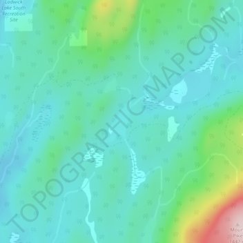
Name: Hall Lake topographic map, elevation, terrain.

Location: Hall Lake, Area H (Manning Park/Tulameen/Siwash), Regional District of Okanagan-Similkameen, British Columbia, Canada (49.73369 -120.69948 49.73448 -120.69787)

Average elevation: 3,865 ft

Minimum elevation: 3,652 ft

Maximum elevation: 4,708 ft

Other topographic maps

Click on a map to view its topography, its elevation and its terrain.

Gear up for your next adventure:

🔦LED Headlamp - Bright and durable LED headlamp for night navigation
🪶Survival Guide Book - Expert advice for emergency preparedness
📱Solar Portable Charger - Solar power bank for charging devices off‑grid
🔋Rechargeable Batteries - Power up your outdoor devices
📷Action Camera - Capture your outdoor adventures in HD

As an Amazon Associate, this site earns from qualifying purchases at no extra cost to you.