

Tepi topographic map
Click on the map to display elevation.
Tepi
Tepi (also transliterated Teppi and Tippi) is a town in southern Ethiopia. The vowels in the name are pronounced as in the English words tape and pea. Located in the Sheka Zone of the South West Ethiopia Region, this town has a latitude and longitude of 7°12′N 35°27′E / 7.200°N 35.450°E / 7.200; 35.450 with a mean elevation of 1,097 meters above sea level. The town is said to be named after a Majangir man who once had a bee hive in the large tree that stood in the marketplace.
About this map
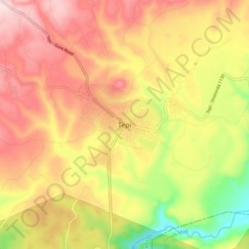
Name: Tepi topographic map, elevation, terrain.
Location: Tepi, Sheka, South West Ethiopia Peoples, Ethiopia (7.15707 35.38182 7.23707 35.46182)
Average elevation: 3,960 ft
Minimum elevation: 3,304 ft
Maximum elevation: 4,462 ft