
Thank you for supporting this site ❤️
Make a donation
Make a donation
Gear up for your next adventure:
As an Amazon Associate, this site earns from qualifying purchases at no extra cost to you.
Orocco topographic map
Click on the map to display elevation.
Thank you for supporting this site ❤️
Make a donation
Make a donation
Gear up for your next adventure:
As an Amazon Associate, this site earns from qualifying purchases at no extra cost to you.
About this map
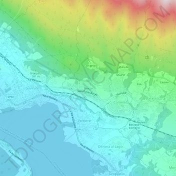
Name: Orocco topographic map, elevation, terrain.
Location: Orocco, Comerio, Varese, Lombardy, 21025, Italy (45.82279 8.71594 45.86279 8.75594)
Average elevation: 1,339 ft
Minimum elevation: 755 ft
Maximum elevation: 3,255 ft
Thank you for supporting this site ❤️
Make a donation
Make a donation
Gear up for your next adventure:
As an Amazon Associate, this site earns from qualifying purchases at no extra cost to you.